This morning a fellow Iknitarod knitter posted a FREE gps link. A few days ago I almost sprang for the Iditarod gps but decided if I did I would be so fascinated I might never do anything else again. I was proud of my then restraint. sigh
However I spent a good part of the morning on that free site following Newton to the Dalzell Gorge
and down it to Rohn Roadhouse. The gps site has a choice of viewing methods. This one is the aerial view with the red line simulating the trail.
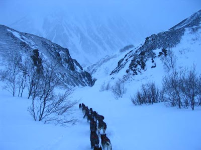
Zuma, dog reporter, explains it this way. -- Before climbing high into the mountains, the dogs and mushers come to Rainy Pass Checkpoint, which is located on Puntilla Lake at Rainy Pass Lodge – elevation 1800 feet. After leaving the checkpoint, the teams climb high into the Alaska Range to a valley that cuts through the mountains and is the highest point of the Iditarod Trail. This valley is the TRUE Rainy Pass – elevation 3,160 feet.
 The run to Rohn from Puntilla Lake is 48 miles and takes four or five hours. From Rainy Pass Checkpoint, it’s a steady climb to the TRUE Rainy Pass. After reaching the trail summit it’s a sharp downhill run into the cold Interior of Alaska and the Rohn Roadhouse. This is the famous and feared stretch of trail known as the Dalzell Gorge. In two miles the trail drops hundreds of feet as it jumps back and forth across Dalzell Creek on narrow ice and snow bridges that span open but shallow running water. Imagine how fast that water must be flowing to not freeze! Depending on weather and snow conditions, the Dalzell Gorge can be a nightmare or just a challenge. From where the creek meets the frozen Tatina River it’s just 5 more miles to the Rohn Roadhouse Checkpoint.
  After that run, it’s no wonder that the dogs and mushers are happy to see the one lone cabin that is called the Rohn Roadhouse Checkpoint – population zero. In the old days, there was a roadhouse near this location for the dog teams and drivers who carried mail and others supplies into the interior. After the airplane took over for the dog teams, the roadhouse wasn’t maintained and eventually fell down. In 1930, The Bureau of Land Management (BLM) built the cabin used as the checkpoint today. It’s a beautiful spot, sheltered from the wind by larger majestic spruce trees. Before the BLM made improvements on the trail that runs through the Farewell Burn, many mushers chose to take their 24-hour rest in Rohn. Now it’s likely that mushers will move further up the trail before taking their long mandatory rest.
 At Rohn Roadhouse many mushers pick up some of the supplies that were sent out to specific checkpoints from Anchorage before the race started.
After Rohn the mushers run through an area called the Farewell Burn. In the summer 1978 1.5 million acres burned in Alaska's largest ever forest fire. Since 40 miles of the Iditarod Trail runs through this area it got a big reputation for difficulty. It is no longer as hard to run as then but it is still desolate and if not well covered in snow can be tricky.
Last I checked, Newton (#14) was now running the Burn and is currently at mile 179. 39 more to get to Nikolai.

And my knitting is racing right along. I got down the gorge with no broken bones today.

Baby Mae's hat is completed, the sweater before the start of the race.
And the Burn is giving me no trouble either.

Some lovely hand dyed Falkland sportweight yarn was swatched for my spring sweater.
One sock is 1.5 inches from completion.
Latest top standings.


No comments:
Post a Comment